Earlier this year, Professor Chris Pettit and Dr Ori Gudes have been awarded $20,000 grant from the National Heart Foundation for a study focused on the GreenWay. The GreenWay is a sustainable transport and urban environmental corridor containing a network of footpaths, cycle-ways, parks, playgrounds, bush care sites, cafes, public art and community facilities in Sydney's Inner West, it connects two of Sydney’s most important waterways, the Cooks River and Iron Cove Bay, part of Sydney Harbour. Active Transport is a direct reflection of the city’s liveability and vibrancy. The variety of factors inclining our travelling preferences in favour of walking or cycling range from access to transit, and population density to perceived pedestrian safety and street design.
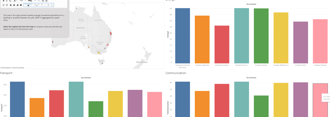
Currently, there isn’t a standard approach to measuring walkability or cyclability. Therefore, the primary aim of this study is to measure active travel rates along the GreenWay, before, during and after the completion of the Central and Southern Greenway Missing Links. The study adopted mixed spatial methods and visualization techniques to collect and analyse the required data. Data was collected, cleaned, analysed and then hosted on an easy-to-use dashboard or Map Story (see attached figure). Furthermore, this work built upon recent City analytics initiatives including: (i) the urban big data CityViz, platform, (ii) city dashboard and (iii) city datastore smart city infrastructures deployed by City Futures. Upon completion of developing the central and Southern Greenway Missing Links, another round of data collection and analysis will be undertaken. It is hoped, that our new dashboard will be used to inform policy-makers and planners in the Inner-City West (ICW) council and other local organisations to promote Active Travel behaviours.